ESA’s Sentinel-3A was successfully launched on the 16th of February. On board it has four instruments: Ocean and Land Colour Instrument (OLCI), Sea and Land Surface Temperature Radiometer (SLSTR), Synthetic Aperture Radar Altimeter (SRAL) and Microwave Radiometer (MWR). Amongst other marine and Earth observation applications, these instruments will allow Sentinel-3A to map sea-level change and surface temperature, perform water quality management and monitor vegetation health.
Three point-to-point SpaceWire links are used between the higher data rate OLCI, SLSTR and SRAL instruments and the Sentinel-3A payload data handling unit (PDHU).
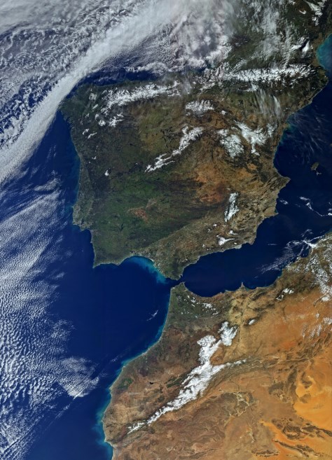
The image shown features Spain, Portugal and North Africa and is one of the first images taken by the OLCI instrument.
For more information please see the ESA Sentinel-3 website.
Image © Copernicus data (2016)